
Most borders are invisible from orbit, but not all of them. This photograph, taken from the International Space Station and shared by Commander Chris Hadfield on Twitter is a rare sight. It shows the border between Israel, Egypt, and the Gaza Strip, and serves as a clear visual indicator of the conflict and division between these nations.
Egypt is on the left, Israel on the right, and you can see the Gaza Strip starting at the border near the water and going right — it’s the grayish portion above the curve.
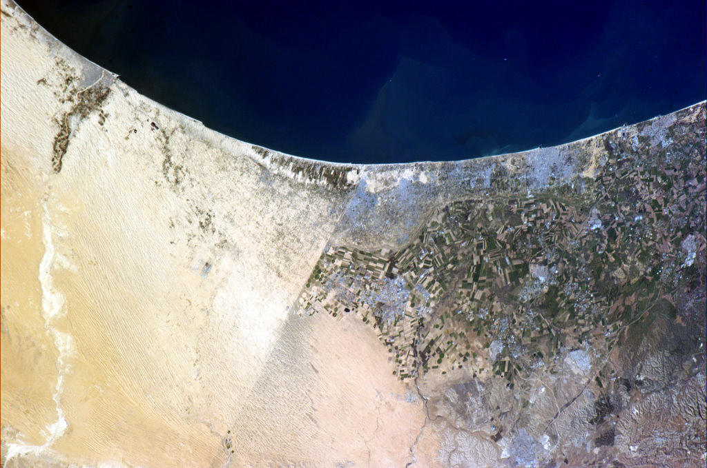 Image Credit: NASA
You may be interested in reading some of our articles on the conflict:
What will happen if aid stops flooding to Gaza?
About the Author

More articles by Natasha Lipman »


